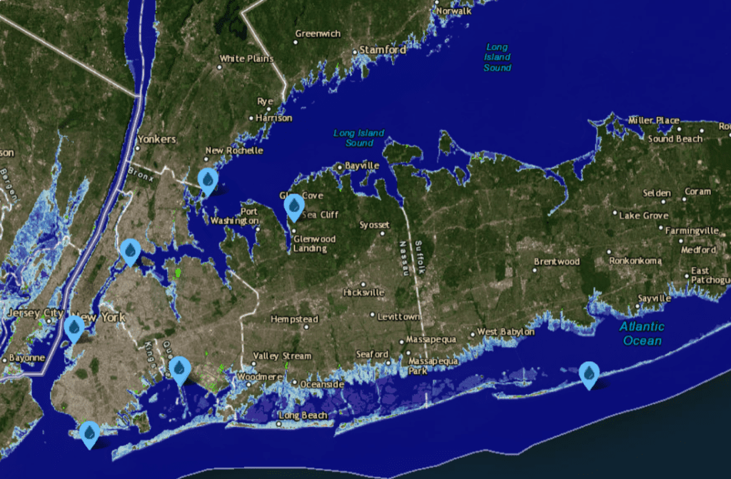
 An interactive map by the National Oceanic and Atmospheric Administration (NOAA) shows “worst case scenario” sea level rise of 6.6 feet by 2100 – which the Intergovernmental Panel on Climate Change (IPCC) says “cannot be rules out” – would impact New York State as far north as Albany County. At that level, devastating impacts would be felt in the New York City metropolitan area, including the submergence of shorelines and Long Island barrier islands.
IPCC estimates that there will be 1.4 to 2.8 feet of sea level rise by the year 2100, but a rise of 6.6 feet is possible. Between 1901 and 2018, average global sea level rose by 6 to 10 inches, an average of 0.039–0.079 inches per year. Sea level rise accelerated to 0.182 inches a year for the decade 2013–2022.
Recent climate change impacts have accelerated as global temperatures rise. “We already see effects scientists predicted, such as the loss of sea ice, melting glaciers and ice sheets, sea level rise, and more intense heat waves,” according to NASA.
The year 2023 was the warmest on record at 1.48 °C (2.66 °F) above the level of 1850, when regular tracking began. That’s 0.27°F above the previous record set in 2016. The 10 warmest years in the 174-year record have all occurred during the last decade (2014–2023)
 The World Meteorological Organization estimates a 66% chance of global temperatures exceeding 1.5 °C warming from the preindustrial baseline for at least one year between 2023 and 2027.
The NOAA map shows that a 6-foot rise in sea levels would decimate Coney Island, The Rockaways and other barriers islands along the south shore of Long Island. Large portions of LaGuardia Airport would be underwater. Major impacts would be felt across the New York Metropolitan area.
Impacts would also be felt all the way up the Hudson River Valley as far as Albany County, where parts of Menands and Watervliet would be impacted.
You can see the map here.
Illustrations, from above, courtesy NOAA: Sea Level Rise and Coastal Flooding Impacts around Metropolitan New York City at 6 feet ocean rise; and the impact of 6 feet rise in the Capital District.


