
 What follows is a report made by the directors of the Northern Inland Lock Navigation Company of the country between the Hudson River and Lake Champlain. The expedition during which this survey was conducted was led by Philip Schuyler in September 1792 to establish a route for the Champlain Canal.
By the act of incorporation, the navigation of Hudson River, from the mouth of the creek on which the grist mill occupied by Colonel Rensselaer [Nicholas Van Rensselaer, 1754-1848, or Colonel Kiliaen van Rensselaer, 1717–1781] is erected in the town of Troy [possibly the Poesten Kill or Wynants Kill] to opposite the house of Mr. Tibbets [George Tibbits, 1763–1849] in Lansingburgis to be rendered navigable for boats drawing four feet water when loaded.
Your committee therefore examined the rapid just above the said creek and that which is half a mile higher up the river and at the upper end of Whale Island and found that although the work contemplated on the view in August last would be adequate to the immediate object of affording four feet water between the points above mentioned.
Yet they would but very little, if at all, facilitate the navigation to Waterford, and found that such a beneficial alteration of the intended works might be made as to embrace both objects; that is, efficiently to improve the navigation to Waterford as well as to Lansingburg; your committee will hereafter particularize the contemplated improvement in this place.
 [Whale Island was once a well known place in the Hudson River between Van Schaick Island and Lansingburgh that was submerged due to river engineering. It’s believed that Henry Hudson sent his ship’s boat [from the Old Anchorage] as far as the rapid here, the first formidable rapid in the Hudson River. It was also here where a whale was apparently stranded in the 1640s.]
[In the 1850s it was about 500 feet long and fifty feet wide and five or six feet above the water in the middle and a grandstand for watching rowing regattas was once erected here. In the mid-1860s the island, by then stripped of all its trees for a corn field, began washing away and was completely gone after a major flood in 1869. By 1872 it was completely gone.]
They then proceeded to the rapid next beyond the creek above mentioned which extends about thirty yards; the perpendicular height of the whole fall about two feet, and in the present very great drought, boats drawing one and a half feet water only can be carried over the rapid. Bottom rocky.
 On about half a mile in gentle current, two feet water, to the foot of the rapid at Whale Island – this extends about two hundred and fifty yards – the whole fall about three and a half feet; depth of water about one and a half feet, bottom rocky; breadth of the river about four hundred and seventy yards.
On in gentle current and deep water about one and a quarter miles to the rapid below, and at Waterford, of these there is succession for half a mile, with small intervals, of deep water; the water on the rapids about one foot; the descent about four feet; through winding channels with turns too short for large rafts, or even boats of a length to carry four hundred bushels of wheat, except in freshets; the bottom all rock; breadth of the river at Waterford about three hundred and twenty yards.
On from the head of the rapids last mentioned; two miles to Schonhoven’s rapid, water deep, current gentle; this rapid extends near half a mile apparently, about nine feet fall; the water on the rapid shallow, not exceeding one foot in general; the bottom all rock; breadth of the river about three hundred and sixty yards.
[Jacobus Van Schoonhoven (1744-1814) was a colonel of the 12th Albany County Militia Regiment (Van Schoonhoven’s Regiment of Militia) during the American Revolution. He was born in Waterford to Guert Van Schoonhoven and Anna Lansing.]
On in deep water about one and a half miles to the Owl rapid; this extends a quarter of a mile, has one sharp pitch, on which great velocity of water then descends, with a diminished fall; the water sufficiently deep on the pitch but on every other part so shallow as to be only passable with an empty boat; the bottom all rock; breadth of the river about three hundred and fifty yards.
[“Owl’s Rapid” (or Wathojax) was in the original Halfmoon Patent, an important early settlement between the Mohawk and Hudson rivers.]
On in good water gentle current, about one and a quarter miles to the foot of the rapids at Fort’s; these extend three quarters of a mile, very rapid and totally impassable, except with an empty batteau; whole height of the fall about nine feet; the bottom rock; the bank on the east side high, on the west low, the land a loose soil, and is fifteen chains across to the rising grounds, breadth of the river about four hundred and thirty yards.
 On one and a half miles on water, gentle current, to the rapids at Fonda’s [above Waterford]; here is a continued rapid, and falls for two and a half miles to the deep water above the falls [at Stillwater], where Messrs. Palmer and Vandenbergh’s mills are erected [at what is now Stillwater]; nothing but empty batteaus can pass, and these not without being drawn over the rapids by hand; the bottom all rock; the river in general about half a mile wide.
On from the falls at Stillwater to the mouth of Batten Kill, about twelve miles in perfect good water, current imperceptible; here a small rapid, over which upwards of two feet water may be carried; bottom rocky.
On one mile to the Little Falls [Saratoga Falls near Schuylerville]; impassable for loaded boats; bottom all rock; rapids above the falls extending one quarter of a mile, the waters on them shallow; the breadth of the river at the falls about three hundred yards.
 On two and a half miles through deep water, gentle current, to the foot of the Fort Miller Falls [known as the second, or little carrying place]; from the deep water below, to the deep water above the falls, the distance on a straight line, is about forty-two chains.
Height of the whole falls seventeen and a half feet; impassable for boats of any kind, except empty boats descending the river in freshets; breadth of the river at the falls three hundred and fifty yards.
On one and a half miles in perfectly good water to the Crooked rapid [now known as Crocker Reef]; here the velocity of the current strong, but great plenty of water; the rapid extends about three hundred yards.
On in perfectly good water one and a half miles to a small rapid extending about ten yards; bottom rocky; depth of water nearly four feet.
On in perfectly good water, five miles to just above the ferry below Fort Edward.
From Fort Edward, left the river to explore the creek which falls into Hudson river at Fort Edward; this creek [Fort Edward Creek] has very little fall in it, and sufficiency of water to supply a canal from the south end of the Great Swamp, which is about four miles [north] from the Hudson River.
 In all the extent between the river and swamp, the ground good for a canal; the fall in this creek has not been ascertained by actual measurement, but your committee, from a variety of information, as well as their own inspection, do not suppose the whole fall to exceed eighteen or twenty feet.
The Great Swamp extends about four miles to Wood creek, is apparently a perfect level, part of it well covered with timber, and part entirely without; even in this dry season the ground is so soft, that unless the foot is placed on tufts of grass which grow in the swamp, a man sinks half leg deep in mud and water.
On four miles along Wood creek to its junction with Half-Way Brook [at Fort Anne].
From the junction above mentioned, your committee descended in a batteau without any obstructions, other than those arising from great quantities of timber fallen or drifted into the creek.
 A sufficiency of water in every part; the current gentle; at about two miles short of the Falls of Skeensborough [sic, Skenesborough, now Whitehall], a large pile of timber in the creek prevented the passage of the boat; we had then gone about sixteen or seventeen miles, sent the boat back, which returned to the junction above mentioned, about an hour after sunset.
The committee walked to the falls from where they left the boat; were informed that there was great plenty of water in the intermediate distance; the whole height of the falls about fifteen feet to the deep water in Lake Champlain.
Having thus stated the whole route from the mouth of the creek below Lansingburg to the waters of Lake Champlain, it remains to state the improvements which ought, in the opinion of your committee, to be made.
1st. A dam across Hudson River at the upper end of Whale island, of such height as to back four feet of water both on the rapids in the northernmost branch of the Mohawk river, where is now the usual fording place, and on the rapids at and immediately above Waterford, in Hudson River, it is conceived that a dam of eight feet perpendicular height would be amply sufficient.
At this dam, a lock, to enter a canal formed by a dike or embankment, to run parallel to the east bank of Hudson River, and of about six feet perpendicular height; the dike or embankment to be made of timber, filled in with loose stones, and to extend from the dam to the mouth of Mill Creek, where a lock must also be placed.
From Waterford to Stillwater, there are two modes of improving the navigation; the one by dams, locks, canals, and dikes or embankments in the river, to wit:
One dam at the head of the rapid above Waterford, with guard-gates and a canal, embanked like that already described, of about three hundred yards, and a lock at its lower end;
 Two dams, with similar canals, embankments, guard-gates, and locks, at Schonhoven’s rapids, each of the embankments to extend about half a mile;
One dam, guard-gates, lock, and embankment, at the Owl rapid, the embankment to extend about a quarter of a mile;
One dam, guard-gates, lock, and embankment, at Fort’s rapid, the embankment to extend nearly one mile;
An embankment from the foot of the rapids at Fonda’s, parallel to the west bank of the river, and to extend nearly to the foot of the falls near Palmer’s mills, distance two and a half miles; four locks will be requisite here; from hence a canal through the land back of Palmer’s house, and to enter Hudson river at the ferry above the falls, distance about forty-seven chains.
Your committee have traced the canal last mentioned and the embankments to the deep water below Fonda’s, measured the distance from thence to the head of the rapids at Fort’s, taken the levels, and traced a canal on the land from thence to Waterford.
This report was very mildly edited for formatting and ease of reading and annotated by John Warren.
Read more about the Champlain Canal.
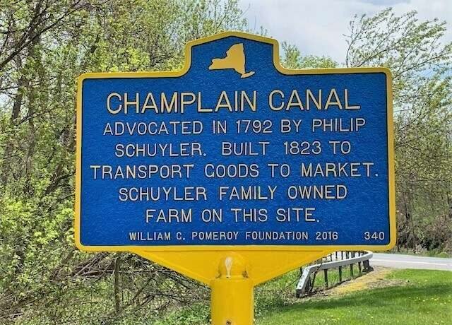
Illustrations, from above: Champlain Canal historic marker in Schuylerville (courtesy Pomeroy Foundation); “Map of the Confluence of the Mohawk and Hudson Rivers, with the villages and islands,” 1843, showing Whale Island in red (larger version online here); “A colored map of the route between Albany and Oswego; drawn about 1756, on a scale of 2 miles to an inch,” originally in the British Museum, a larger version online here, showing the various Hudson River rapids from the Mohawk River to that identified above as “Fort’s”; the same map, showing from “Fort’s” to the falls below Stillwater and the Hoosick River; “Map and profile of the Champlain Canal as made from Lake Champlain to the Hudson River and surveyed thence to the tide at Waterford, by Jas. Geddes, 1820, originally in the Boston Public Library, a larger version is online here, showing the Hudson River between Schulyerville and Fort Edward; Same map, showing the Champlain Canal between Fort Edward and Fort Ann, including Fort Edward Creek, and the Great Swamp noted above, and also “Stone for Locks” (the stream flowing from Fort Anne toward the “Iron Works” is Halfway Brook; Same map, showing Wood Creek and the Champlain Canal from Fort Ann to Whitehall and the south end of Lake Champlain; and the Champlain Canal, 1895 by Howard Pyle.


Recent Comments