
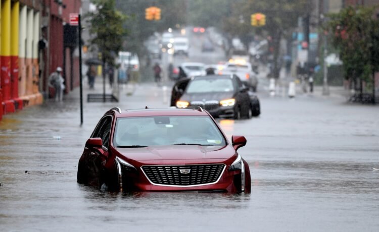

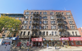
More than 80,000 homes in New York City’s low-lying neighborhoods and surrounding suburbs are at risk of being lost to flooding in the next 15 years, according to a new report. Released Monday by the Regional Plan Association (RPA), the report warns that the region’s housing shortage could reach 1.2 million homes by 2040, as heightened flood risks render large portions of land across the five boroughs undevelopable. While Long Island is projected to face the most significant impact overall, waterfront neighborhoods in southeast Queens, Brooklyn, and Staten Island are among the most vulnerable.
“In the middle of an ongoing housing crisis facing metropolitan regions across the U.S., this report highlights the increased danger that climate-influenced flooding poses to communities,” Tom Wright, president and CEO of RPA, said.
“To meet current and future demand, the region’s total housing needs could reach 1.2 million units by 2040. Our leaders must step up with bold and innovative policies and investments to address this challenge, before it becomes even worse.”
Amid the city’s worsening housing crisis, the skyrocketing cost of living has pushed many New Yorkers out, making it increasingly difficult for the average resident to sustain a life in the five boroughs. These issues are exacerbated by restrictive zoning policies that limit the types of housing that can be created.
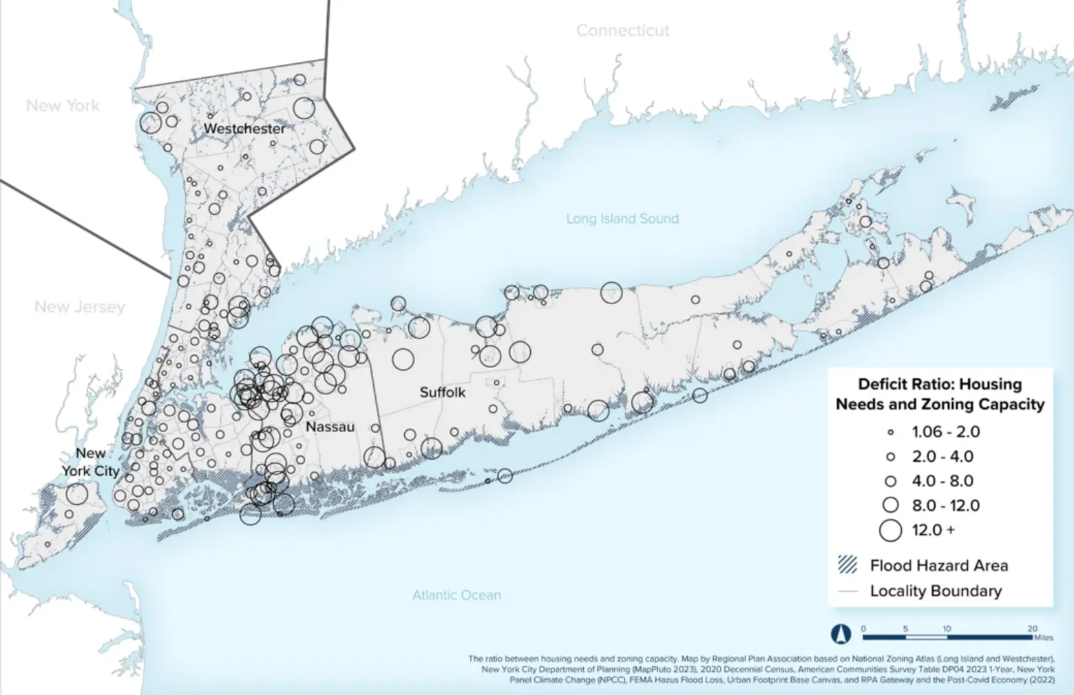
Currently, about 85 percent of residentially zoned land in the region is limited to single-family housing, with half of that requiring a minimum half-acre lot to build a home, according to the report.
While the city has begun addressing these issues by updating outdated zoning laws and proposing major reforms to build thousands of new homes, another growing threat could disrupt these efforts and worsen the crisis: flooding.
“You’re going to need to build more housing to just replace what is lost in your own municipality,” Moses Gates, RPA’s vice president for housing and neighborhood planning and an author of the report, told the New York Times.
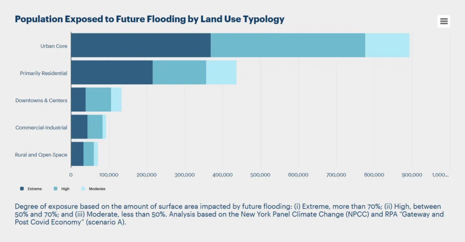
According to the report, current adaptation measures in use in coastal regions meant to protect at-risk communities are “slow, narrow in scope, and unable to deliver fundamental transformations.” Roughly one million houses and multifamily buildings in the tri-state area are at risk of flooding, while nationwide, the number of vulnerable affordable housing units is expected to triple by 2050.
The report did not highlight specific neighborhoods at risk of flooding, but of the 82,000 homes that could be lost by 2040, more than half are expected to be on Long Island, where towns along the Atlantic Ocean, like Babylon and Islip, would bear the brunt, according to the Times.
Cities along the Long Island Sound, both on Long Island and in Westchester County, would also be highly vulnerable. Within New York City, neighborhoods such as the Rockaways and Canarsie are expected to experience the most severe impacts.
Flood-prevention projects currently underway include the Arverne East development in the Rockaways. This project aims to provide much-needed affordable housing while incorporating resilient design elements, such as bioswales to reduce flooding and elevations ranging from three to eight feet above the existing ground level—four feet higher than the city’s required flood elevation standard.
In Manhattan, the Battery Coastal Resilience Project is underway. This $200 million initiative aims to rebuild and elevate the wharf promenade in The Battery as part of a larger effort to strengthen Lower Manhattan against rising sea levels and storm surges.
These projects are being developed in response to projections that rising tides will cause monthly flooding in the Financial District and Seaport by the 2050s, with daily flooding expected by the 2080s. Some areas may experience frequent tidal flooding as early as the 2040s. However, a robust plan to protect the entire city is still decades away from completion.
The report offers several recommendations for cities and towns, including focusing new developments in areas with lower flood risks near public transportation and commercial centers. It also suggests further modifying zoning codes, noting that data from the National Zoning Atlas reveals current restrictions allow for only 580,000 new homes—less than half of the 1.2 million needed by 2040.
Additionally, areas that are highly vulnerable to future flooding and have limited potential for smart growth may require alternative strategies, including “managed retreat,” repurposing existing land, and imposing restrictions on certain types of residential development.
Climate experts are suggesting that developers rethink standard housing, forgoing the “suburban ideal” of standalone homes in favor of denser, more energy-efficient options, as reported by The Real Deal.
RELATED:


Recent Comments