
 Relative to the New York-New Jersey metropolitan area, Staten Island has been both water-bound and isolated. Historically, the island’s western border, the Arthur Kill channel, and its northwestern border, the Kill Van Kull, played vital roles connecting New York with New Jersey, Philadelphia, and Long Island Sound.
Staten Island rests between New York Bay and New Jersey’s northwestern shoreline, the Arthur Kill channel separating the Island from the latter. The Island’s geographical center is situated 11 miles southwest of New York City.
The Kill Van Kull extends from Newark Bay to New York Bay and separates Staten Island’s northwestern shoreline from New Jersey at Bergen Point. The Island’s name is an English rendering of the Dutch form Staaten Eylandt, meaning “States’ Island.”
The name “Kill Van Kull” (channel), historically known as the Kills, is apparently Dutch for the “Kill of the Cul” (Het Kill van het Cul). Kill is a Dutch word for “creek,” while Cul is possibly French for “bay,” thus “the creek of the bay.” Achther Cul, the Dutch rendering for Newark Bay, meant “Back Bay,” the Dutch word achter meaning “after” or “behind.”
In 1655, David Pietersz de Vries commented on the immense numbers of water fowl on the Achter Cul, stating:
“There are great numbers… of geese, which stay here through the winter, by the thousands, and which afford fine sport with a gun… Land birds are also very numerous, such as wild turkeys… taken by the savages with their hands, who also shoot them with bows and arrows… There are different kinds of fine fish… haddock, plaice, flounders, herring, sole, and many more kinds… There are fine oysters, large and small, in great abundance. In the summer time crabs come on the flat shores, of very good taste.”
 The description offered by De Vries is a far cry from the fouled and polluted waters of the modern Arthur Kill and Kill Van Kull channels.
Initially, Native American conflict hampered European development of Staten Island. As part of the Province of New Netherland, the Island fell under the jurisdiction of the Dutch West India Company (1621 to 1664).
In 1661, French Waldenses and Huguenots established a modest village near South Beach, apparently the Island’s first permanent European settlement.
The Dutch surrendered its Island claim to England in 1664. Native American conflict culminated in the Peach War of 1655, which temporarily depopulated the Island. Staten Island became part of the shire of Yorkshire.
Francis Lovelace (ca. 1621-1675), an English Royalist and the second Governor of New York colony, purchased Native American land rights to the island in 1670, laid out lots on the Island’s north, south, and west sides. In 1675, the Island obtained separate jurisdiction, and in 1683, a separate county, Richmond.
Demographically, seventeenth-century Staten Island mirrored early Dutch and subsequent English settlements. Under English domain, the Island witnessed the arrival of fugitive French Huguenots in significant numbers. By the mid-l700s, Staten Island included Dutch, French, Belgian, and English populations.
Between 1790 and 1810, the Island featured a rural population subsisting on farming, fishing, and maritime commerce. The population (5,347) increased more than 39 percent by 1810.
Agriculture (beef, pork, wheat, rye, apples) and seafood (fish, clams, oysters) sustained the Island’s population. The community also harvested salt hay from the extensive salt meadows in Northfield, Southfield, and Westfield townships.
Commercial oystering dates from the earliest Dutch settlements. The industry even advertised in early Dutch journals. Considered a staple in the eighteenth century, oysters were shipped locally and abroad. Beds thrived in the Arthur Kill’s deeper waters, Prince’s Bay, the mouth of the Raritan River, and the Kill Van Kull.
Extensive marshes north of later Rossville, coupled with the Island’s remoteness (relative to the New York City and Philadelphia markets), slowed coastal development.
There was little settlement east of Palmer’s Run (later called Bodine Creek) – this area was part of a large area owned by John Palmer and Thomas Donegan (governor of New York, 1682–1688), who built several mills in Palmer’s Run in the 1680s.
 These mills, particularly a grist mill built by Donegan where Richmond Terrace crosses Bodine Creek, served a wide area, including farmers as far away as Bergen Point, until 1795.
This mill was replaced by a new flour mill just west of Broadway, built by John McVickar, who had recently purchased the Donegan estate. This mill was powered by a diversion of Palmer’s Run to a pond which fed the mill’s race. This system of waterpower powered the island’s first large industry after 1819.
Furthermore, large land grants encompassing the Island’s southern end restricted settlement. Mark Dusachoy, described in a seventeenth-century deed transaction as a “planter,” held some 823 acres in the Smoking Point area.
Christopher Billopp received about 1,600 acres on the Island’s southwest corner. Begun circa 1709-1716 and running between Perth Amboy and the end of Amboy Road, the earliest ferry across the Arthur Kill was included in Billop’s grant.
Besides local ferry service, given opportunity, the Billopp ferry probably served as a link between New York City and Philadelphia. The ferry operated intermittently from the Amboy Road site until the beginning of the Civil War, when the landing moved a half mile north.
By the end of the colonial period, subdivided Billopp grants, together with other smaller grants, led to increased farming near the Arthur Kill south of Fresh Kills. Eventually smaller communities emerged north of the Billopp grant boundaries as New York and Philadelphia markets expanded.
The initial franchise, Old Blazing Star, is located in an area north along the south side of what is now Arthur Kill Road (prehistoric Smoking Point).
The name “Blazing Star” apparently originated from taverns at each ferry site. Old Blazing Star remained the area’s principal settlement until after the American Revolution. The New Blazing Star Ferry at Tompkinsville (Linoleumville) opened around 1757 and by 1764 featured a stagecoach connection.
One of the earliest ferries to cross the Kill Van Kull, the Port Richmond-Bergen Point ferry, dates to the 1690s. Jacob Corsen petitioned the New York Governor’s Council in 1750 for a patent stating that he had operated a ferry between Staten Island and Bergen Point for some 60 years.
His request, to “erect” his vessel into a public ferry, grew out of fear of competition as a result of increased population. Corsen received the patent, operating the ferry until 1764. New owners took over the operation the same year.
Isaac Decker took over the ferry in 1774, and operated it until 1780. During this time he added a direct freight and passenger ferry to New York City. Another early ferry operating in the area was the Howland Hook ferry, which was built on the edge of a large marsh, and was accessed via a causeway. It was operated by one Adoniah Schuyler from 1736 until the Revolution.
 The New Blazing Star route began in New York City, crossed the North River by ferry to Powle’s Hook (Jersey City), to Bergen Neck (Jersey City and Bayonne), to Bergen Point, where the ferry carried passengers and freight across the Kill Van Kull.
The New Blazing Star differed from the Old Blazing Star ferry, which ran from modern Rossville, Staten Island to the opposing New Jersey shoreline. The New Blazing Star did not operate during the Revolutionary War.
British forces occupied the island during the Revolutionary War. Up to 40,000 garrisoned British and Hessian troops occupied the island, many stationed near the western shore. This was perhaps due to the location of the Old Blazing Star ferry and its subsequent access to Philadelphia and New Jersey.
After the war, local officials confiscated and subdivided the grant’s remaining acres. Development of the island’s hamlets, villages, and industry depended, in part, on transportation networks, i.e., ferries, landings, and roads.
Ferry service provided early links with the mainland. By 1816 Daniel Tompkins’ Richmond Turnpike Company opened a road connecting the northeast shore (Tompkinsville) with the New Blazing Star Ferry west in Linoleumville. Tompkins then offered steamboat service between Tompkinsville and Manhattan, establishing a direct route between New York and Philadelphia.
The ferry at Tottenville linked Staten Island with Perth Amboy, and the one at Holland or Howland Hook with Elizabeth, New Jersey. Another ferry ran across the narrows to Brooklyn. Kill Van Kull service ran between Bergen Point and Port Richmond.
In the 1830s, a horse ferry operated across the Kill Van Kull. The vessel, known as Coyles’ horseboat, ran during the late 1830s and early 1840s. The project lasted only a few years, with the service replaced by rowboats or scows.
Despite New York Harbor expansion, the Arthur Kill’s marshy shoreline continued to hamper large-scale commercial development.
In 1810, the Island’s primary industries included two textile carding machines, two tanneries, three distilleries, and 59 looms producing some 23,100 yards of flaxen fabric, 12,000 yards of woolen fabric, and 7,000 yards of blended cloth.
Even as the channel itself became an increasingly important commercial route, communities along the Arthur Kill remained largely agrarian.
Early industrial development began on the north shore at Factoryville, now West New Brighton. In 1819 Barrett, Tileston, and Company established a dyeing and printing house there. Port Richmond served as the location for the Staten Island Whaling Company and later the Jewett White Lead Works (1842).
The Island’s rich clay and kaolin deposits on the southwest shore along the Fresh Kills and lesser deposits on the north shore led to an emerging brick-manufacturing industry.
German immigrant Balthazar Kreischer, knowledgeable in the construction trades, built a Manhattan brickworks in 1845, and in 1852 built the International Ultramarine Works on the Arthur Kill south of Smoking Point.
In 1854, Kreischer established a clay and firebrick works on the Island that operated in several locations, the earliest and largest located along the Arthur Kill south of Rossville. In 1873-1874, he moved the entire manufacturing operation to a three-acre site just north of the Outerbridge Crossing.
In the 1880s, the family-owned plant produced an estimated 3.5 million bricks annually. Kreischerville became an industrial community. The plant shipped all products by water, building a steam lighter in 1880.
 Transportation improvements during the last half of the nineteenth century accelerated Staten Island’s industrial growth. The first railroad linked Clifton with Tottenville in 1869. Small communities developed around the rail stations.
Immediately after the Civil War, heavy industry expanded, especially after the 1880s. The emerging transportation industries and the subsequent communities built near their local hubs brought new occupations and services, providing opportunities for blacksmiths, coopers, wheelwrights, grocers, bakers, and printers.
The Staten Island Rapid Transit Railway Company opened a train bridge over the Arthur Kill in 1889. Coaches and horse cars linked north and east shores with Richmond and Linoleumville to the west.
By 1880 Staten Island’s population totaled approximately 40,000, 90% clustering in villages along the northern and eastern shorelines. The rest of the island remained rural farmland, swamp, saltmeadow, or beach. The Island featured I 00 manufacturing plants employing some 1,550 people, mostly young men, though the plants employed 88 females over 15, and 30 children.
By the mid-1900s, agricultural chemical production facilities, metallurgic industry plants, clay and brick production facilities, building material factories, copper refineries, shipyards, and emerging petroleum industries lined the Arthur Kill’s western shoreline.
At Staten Island only a few small industries appeared: the American Linoleum Manufacturing Company, Atlantic Terra Cotta Company, Kreisher Brick Works, and Tottenville Copper.
In 1920, nearly half of all foreign commerce for the United States entered through the Port of New York. Some eight million people lived within a 25-mile radius of the Statue of Liberty. Yet Staten Island’s Arthur Kill waterfront remained underdeveloped.
Local economic fallout following World War I, limited access, and pollution governed the Island’s future. When the Department of Health traced typhoid fever to Staten Island oysters, the department condemned the industry. Water pollution destroyed oyster beds, and by the early twentieth century, the local fishing business little resembled its admirable past.
Chemical and copper refineries along the Jersey shoreline released gaseous contaminants into the atmosphere. Prevailing westerly winds, in turn, pushed contaminants across the island, ruining agricultural production.
 Industrial waste eventually made Staten Island’s real estate less than desirable. New York City started dumping garbage on the Island in 1916. Initial operations failed in 1918, but in 1946 dumping resumed. Following a series of land transfers, the present Fresh Kills Landfill on Staten Island is considered the largest landfill in the world.
The disposal of garbage, particularly during the nineteenth century, created special problems for local residents. Until 1934, ocean dumping was commonplace. Shoreline residents from Long Island to New Jersey complained of nasty beaches and shorelines.
Dead cats, dogs, and chickens, and putrid fruits and vegetables lined the area shoreline. The problem, recognized by local officials, proved difficult to correct.
The garbage scow, a barge filled with garbage, became commonplace on the rivers and channels. An article in n 1880 New York Times noted that the amount of garbage dumped in the harbor actually filled certain channels.
In 1871, the New York legislature enacted laws prohibiting the dumping of garbage into the waters of the Hudson and East Rivers, Upper New York Bay, and parts of Raritan Bay. As a result, legal dumping moved to southeastern Staten Island.
Read more about Staten Island.
A version of this essay appeared in Target Investigations in Connection with the New York and New Jersey harbor Navigation Project, May 2004, prepared for the U.S. Army Corps of Engineers, New York District, by Andrew D.W. Lydecker and Stephen R. James, Jr. of Panamerican Consultants, Inc.
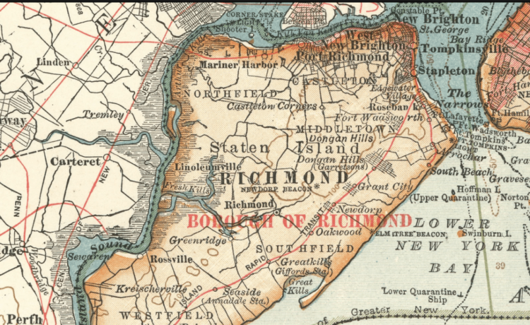
Illustrations, from above: Map of Staten Island, ca. 1900; The Arthur Kill, shown in red, between New Jersey and Staten Island connecting Raritan Bay on the south with Newark Bay on the north; Geib’s Mill (Richmond Mill) on Staten Island, 1899 (Staten Island Historical Society); Staten Island ship building; the Rossville Hotel, ferry stop on the Arthur Kill at the foot of Rossville Avenue in Staten Island, built 1829; and a map of Fresh Kills Landfill (Wikipedia).


Recent Comments