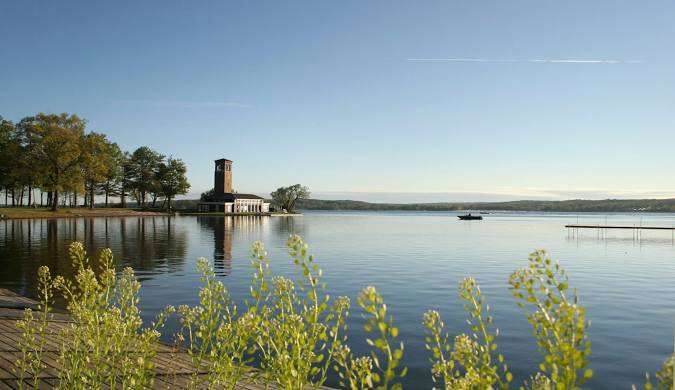
 Chautauqua Lake, located in the towns of Chautauqua, Ellery, North Harmony, Ellicott and Busti in Chautauqua County, is the largest natural inland lake in Western New York.
The lake’s name comes from the now-extinct Erie language. Because the Erie people were defeated in the Beaver Wars before a comprehensive study of their language could be made, its meaning remains unknown and a source of speculation. Two longstanding folk translations are “bag tied in the middle” and “place where fish are taken out,” the latter having some support based on similar words in other Iroquoian languages.
While the lake has a similar geologic structure (a very long, narrow valley), it is not considered one of the Finger Lakes. Chautauqua Lake runs perpendicular to the westernmost of those lakes, in a different watershed, and was formed by a different process. At 1,308 feet above sea level, it is higher than any of the Finger Lakes.
Although relatively close to the Great Lakes, the water from Chautauqua Lake drains south into the Chadakoin River and then travels east into Cassadaga Creek and Conewango Creek, before turning south into the Allegheny River in Pennsylvania, and on to the Ohio River.
This eutrophic lake (rich in nutrients and so supporting a dense plant population) contains two distinctly different basins that provide a wide diversity of aquatic habitats. It is about 17 miles long and two miles wide at its greatest width, with a maximum depth of about 78 feet (in the north basin). The lake has about 43 miles of shoreline.
At the southern end of the lake is the City of Jamestown; the Village of Mayville is located at the northern end. Other communities located on the lake are Bemus Point, Maple Springs, Lakewood and Chautauqua, the site of the influential Chautauqua Institution, founded in 1874.
 The lake is used primarily for boating and fishing, especially for muskellunge fishing and sailing. The lake ranks as the 13th most-fished body of water in New York State
Two popular boating locations on the lake are “Sandy Bottoms” (or The Sand Bar) in the northernmost part of the lake, and “Party Bay,” to the east/southeast of Long Point State Park, near Maple Springs.
There is one bridge that connects the opposite sides of the lake, the Veterans Memorial Bridge (also known as the Chautauqua Lake Bridge), completed on October 30, 1982 between Bemus Point and Stow.
The Bemus Point–Stow Ferry, a free cable guided ferry, still operates during the summer months. The lake is the home of the Chautauqua Belle, a replica sternwheel steamboat constructed in 1975 for the US Bicentennial, which offers sightseeing cruises on the lake.
The lake is managed as a high-quality multi-species fishery, with muskellunge, walleye, and largemouth bass and smallmouth bass as the primary sportfish along with abundant panfish populations.
Additional species include yellow perch, pumpkinseed, bluegill, black crappie, white crappie, white perch, white bass, brown bullhead, yellow bullhead, white sucker, common carp, rock bass, longnose gar and golden shiner.
Chautauqua Lake also serves as the primary brood stock source for the Chautauqua Fish Hatchery‘s pure strain muskellunge stocking in New York State waters.
Access to the lake is provided by launches at Bemus and Prendergast Point DEC Boat Launches; Long Point State Park; Lakeside Park in Mayville; the Lakewood Community Park Boat Launch; and Lucille Ball Memorial Park in Celeron (her childhood home).
Chautauqua Lake Wildlife Management Area is a 123-acre property located six miles northwest of the City of Jamestown. It consists of three different parcels: Tom’s Point, Cheney Farm, and Stow Farm.
Photos, from above: Long Point State Park on Lake Chautauqua;


